San Simeon (4)

Not the desert anymore.

And just like that, we’re back in the land of weather. Travel to San Simeon was not fun. In fact, the last thirteen miles of Highway 46 going down to Highway 1 was some of the most terrifying towing I think I have ever done. That was awful.

We had been watching the weather reports up and down the state quite closely. It looked like we were going to be able to slide between two systems on our travel day westward. That was kind of true, in that it wasn’t raining until the end, and at the Tehachapi Pass, but it was very windy all day. Wind towing is one of my least favorite things. At least, I kept telling myself, it is daytime, it is not raining, and Highway 58 is not as busy as some other highways, if you have to tow in wind. There were few places I could exit or take frontage roads, so it was mostly just hang tight, be ready for the pushing and pulling every time a truck passed, and keep it slow. For a while, we listened to our audio book of “The Fellowship of the Ring,” which is fun and mostly distracting. When it got intense though, we had to pause. I took quick breaks at rest stops and exits, just enough to catch my breath and unclench, and then it was back on the road all the way until Tehachapi.

Climbing up the pass, one could see that there was going to be dense fog and low visibility at the top. Light up signs saying “Dense Fog. Low Visibility.” seemed to confirm that suspicion. I was finally able to get off the highway and take surface streets to the big gas station at the top and look for the alternate route down. I really did not want to be on the highway going down with next to no visibility. The wind was crazy up there and blew the car doors shut when you got out. Weather reports said it was not raining, so there went any credibility out the window.

The Tehachapi Loop

I was able to find the road I had once SAGed Richard on that I remembered not liking. Woodford-Tehachapi Road was narrow and curvy, with deathy edges and a serious descent for twelve miles. Well now it is my favorite road. I love that road. It is the best road ever. Crawling out of town through the thick fog, we started to go down. There was no one behind me or in front of me, so I could go as slow as I pleased and not worry about being rear ended. Almost immediately as we started down, the wind lessened and the fog lifted a little. It got better and better as we went, enough that when we got to the place where we could see the Tehachapi Loop with a train going by, I was downright happy and untense enough to make Richard take pictures.

The cloud layer by the time we reached Keene (and the unavoidable onramp back onto Highway 58), was way overhead now. There was very little wind, and traffic was moving slow and careful the rest of the way down to Bakersfield. What a relief! Traveling across the central valley was easy and the wind was not noticeable on this side of the mountains. I took 58 to 46 and stayed on 46 all the way to Paso Robles. With only about twenty miles to go, I thought I had it licked. And by the time things got socked in, there was really no turning back.

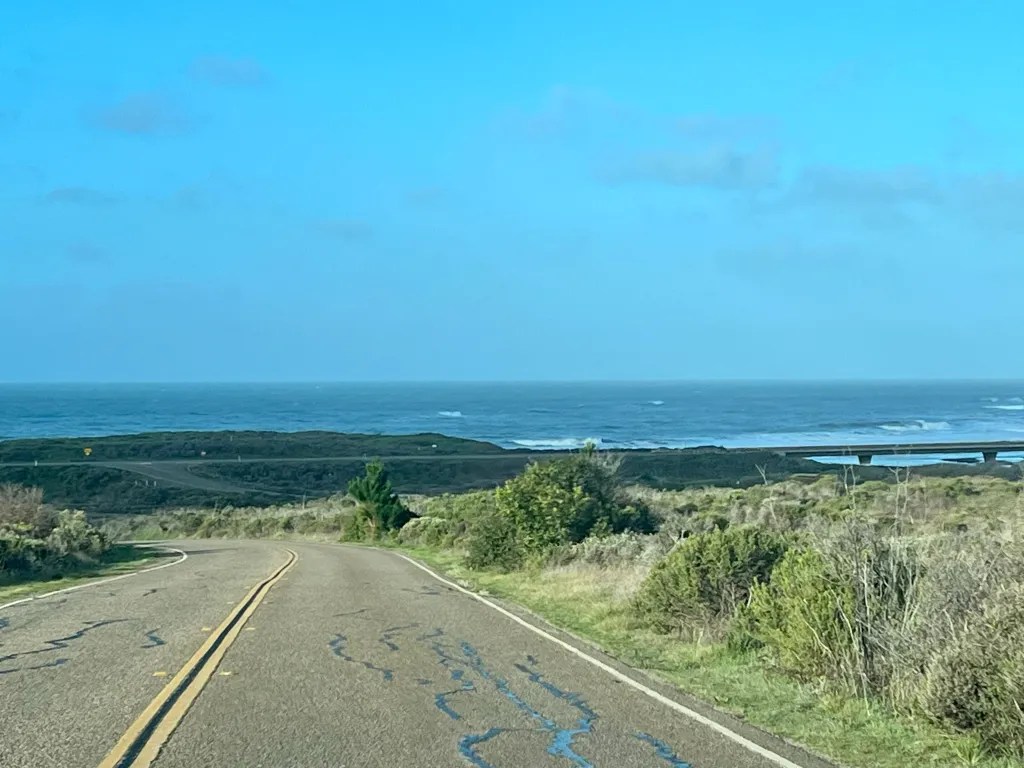
Highway 46 down to the coast is normally rather exhilarating. I mean, the views of the ocean below are gorgeous, but it is not a relaxing drive. It is a long, exposed highway that plummets about 1,500 feet in sweeping curves that are dicey on clear days. And there is often wind. On our approach, it was wind plus that damn dense rainy fog the whole way down. Visibility was so low it seemed like nighttime, the road was wet, and you could only just make out the edges of the curves as you went down them. Maybe that was good though, because seeing the dropoffs on either side of the curves might not have helped. If I had even tried to pull over, there were about ten cars behind me that would never have been able to see me or stop in time. It was death grip on the steering wheel time and just super focus on what I could see of the road ahead. I asked Richard to count down the miles, in tenths, all the way down. “7.1, 7.0, 6.9…” And me repeating, “It’s ok, it’s ok, it’s ok…” By the time we were three miles away from the intersection with Highway 1, it was in fact ok. The visibility improved and the grade calmed down. When you roll to the stop sign, it is finally, blissfully, flat. Then it’s clear sailing just a few flat miles to the campground. I can still feel my shoulders reaching for my ears though. Weather apps insisted it was not raining yet. Stupid weather apps.
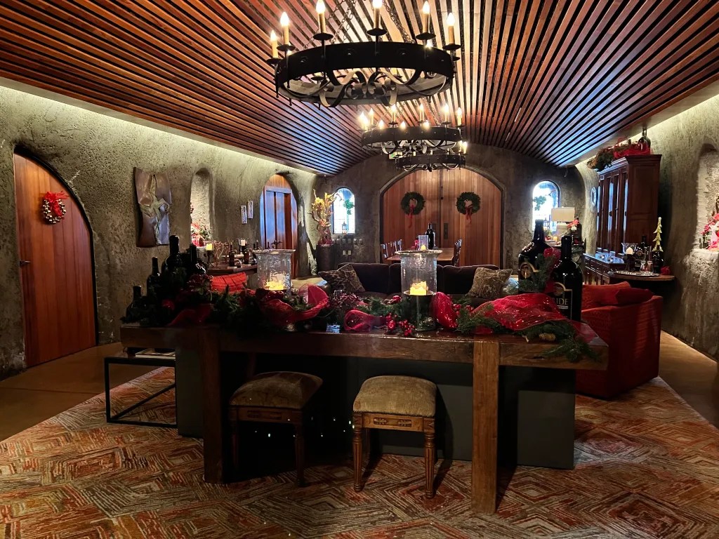
Whew. Made it!

I knew there was no bailing on that day, unless I wanted to be stuck somewhere during the big storm on Saturday. We pulled in and did our best to nose Dory into the direction the stupid weather apps were saying the wind was going to be coming from. Then I had a margarita and we pulled the privacy curtains on our little cocoon of stationary safety.

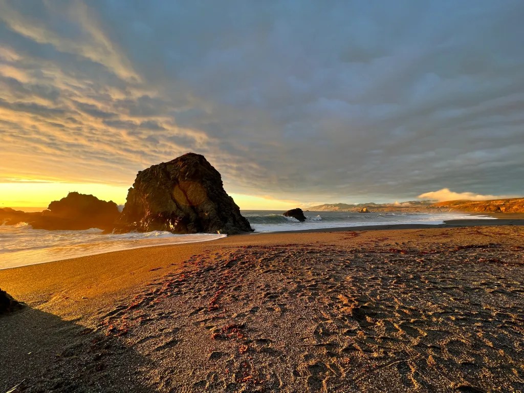
Kept an eye on that tiny little creek…

The big storm on New Year’s Eve took a while to ramp up, so much so that we scoffed a little about this storm being a “nothing burger.” We really should not do that. Ever. Even if it ends up being true. And while we were fine, we found out later that lots and lots of places flooded or slid, all over California.

Palm trees are rugged buggers.

We had reservations for a tour at Hearst Castle in the afternoon, and there was no reason not to do that. Everything was open and trams were running people up the long road to the castle, as per usual. The castle is situated at the top of a hill, about sixteen hundred feet above the ocean. Architect Julia Morgan designed the approach so that, as you bend and climb your way up, the castle comes in and out of view until you reach the top. Of course, we couldn’t see anything through the clouds, but when we got out of the bus, we sure could feel the full force of the storm. We were all geared up in rain jackets, and I put on rain pants, which fared a lot better than the destroyed umbrella of another tour member.

You only know there’s a storm outside because you can’t see the view of the ocean.

Fortunately, most of the tour was indoors, and castles are really the place you want to be in a storm. We could see the palm trees blowing around through the windows, but really couldn’t hear or feel anything inside. That’s what happens when you build things out of thick reinforced concrete.

Lots of fancy bathrooms in this place

The tour itself was fascinating, as they always are. I think we’ve done three now, all different, and I would be happy doing each one again. You always learn something new about the place, or the people who visited. This time I learned that the showers in some of the guest rooms were among the first permanently installed and plumbed showers anywhere. Everything was state of the art at the time, including the fact that there was electrical lighting in every room. That was very avant garde for the times.

The Roman Pool

The outdoor “Neptune Pool” had been restored since the last time I was there, and it is beautiful. Now they are trying to restore the roof of the indoor “Roman Pool,” which is also the floor of the tennis courts. This pool was designed using millions of cobalt blue and gold leaf glass tiles, arranged in a pattern that makes it look like a starry sky. If you jump into the pool from a landing above, it makes you think you are diving upward, into the nighttime sky. As water dripped into the pool through the leaky ceiling, it created shimmering circles of golden reflected light. Dazzling. After the tour, we watched the informational movie in their IMAX theater. We both wondered whether Dory was doing ok in the storm, but figured there would be nothing we could do if we were there, so why not take our minds off our worries a while longer.

Returning to the campground, we saw no evidence of any storm damage and the creek did not seem to have gotten much higher than when we left. Dory was fine and we had done a standup job turning her right into the wind. She hardly even shuddered. It was time for dinner, bed, and be ready for an early departure. We had planned to stay an extra night, but stupid weather apps were all saying Sunday was the break in the rain. We did not believe them at all, but still planned to head back home.

Ok, one point for the stupid weather apps. They called this.

Morning came, and what do you know? The sun was out, the skies were blue, and it was as though nothing had happened. Our drive home was long, but not stressful. We even listened to some more of our audio book to pass the time. We could see small mudslides on the side of the road, but nothing was closed that barred our way.

Once home, we discovered some things had not fared so well, our next door neighbor being the hardest hit. She had a major mud slide from her side of our adjoining hill. Meanwhile, since we are in the process of construction, and since part of our existing roof has been removed in order to connect the new roof for the ADU, our daughter’s room had been raining inside. She did her best to catch the drips with bowls and buckets, but it looked pretty bad. Her floor is toast. It was a wood laminate and is now completely warped and destroyed. The drips coming from her ceiling were not quite so attractive as those falling into the Roman Pool at Hearst Castle. Maybe if she had Venetian glass floor tiles it would make the leaking more fun. The scary part is that there is another big system due to come through. We are happy for all this California rain of course, but we weren’t quite in sync with the timing of the remodel.

Oh well. Just keep swimming…. even if it is in your bedroom because the roof is leaking. Just pretend you’re in a castle.

Total miles from Calico: 288, 15.0 mpg fighting wind, 7 hours 8 min of stressful driving. Site 206 in the Washburn primitive loop. No hookups. Water spigots, vault toilets. Good dump down below in the main campground, but rinse hose was not working this time. Fairly good cell service, but not enough to satisfy our desire to keep updating weather reports.

Calico Ghost Town (4)

The Ghost Town is anything but abandoned during the holidays.

Once again, we returned to our funky little stopover between travel days. The journey was uneventful and went smoothly. Richard got in a short ride up Box Canyon to get his ya-ya’s out. Then we cut through Joshua Tree to catch Highway 247 from Yucca Valley on the other side.

Hey! I spy a Safari Condo van up ahead. It’s a good bet we know who that is!

We knew Francois was in the vicinity with his travel buddy, who met up with him in SoCal. We scanned for vans as we headed up the road, and did in fact catch up with him right after the Cholla Cactus Gardens. His Safari Condo van is a particular shade of deep grey, plus, it has a snail logo on the back, so we knew it was him. We followed along after them on the main road, until they pulled off to park and go look at something. It was very crowded in Joshua Tree that day, so we didn’t want to try to find parking for Dory. Instead, we rolled down the windows as we passed by, and yelled at them to “Get out of the road!!” Waves and kisses were exchanged and I hope they had a blast in Joshua Tree. Now we know we will see him again in the summer, but in the parking lot/campground in Quebec. He promised wine. I’m just documenting that here to hold him to it.

Howdy partners and a Merry Christmas to ye!

We got an early start and made good time, so we got to poke around the ghost town a little bit. It is nicely decorated for the holidays and had more people walking around than we have ever seen there. The parking lot even seemed kind of full and I can’t recall ever seeing more than a couple of cars down there. Of course, there were the New Year’s ATV people, flying their flags and buzzing around in their brightly lit little off road buggies. Even our loop felt hopping.

We can’t skip this…

We rolled in with very little gas – not that we hadn’t noticed; we were monitoring the projected range and miles to go the whole way. So the first order of business was to fill up in town where there are lots of choices for gas stations. Then, it was a short hop around the corner to Penny’s. We would wonder if they were starting to recognize us, but it was a different server this time. I had fried chicken waffles and they were worth every logged calorie.

Fun little stop as we make tracks toward home. We will be dodging severe weather alerts all the way home.

Total miles from Anza Borrego: 243.7, 17.3 mpg, 6 hours 38 min. Site 9, hookups until kid tripped on power cord. Nice dump. Bitsy pieces of service until you get over the little hill bordering the loop. Excellent service above/beyond the hill. Also, Penny’s always has excellent wifi.

Anza Borrego (4)

Most Excellent Desert Christmas

I honestly can’t remember a better xmas. But I can’t remember last week either. My love for Borrego Springs only increases with each visit. This one was just wonderful.

Lovely Box Canyon Road

Beginning with arrival, we took a leisurely path back through Joshua Tree and downhill past the Cottonwood campground on the south side. We used the dump there, which was great, and used it as a stopping location so Richard could start a ride. While there, we checked out the campsites, deciding it would make for a nice stay of a day or two. There is no cell service and no way to climb to a high point to get a signal, so it would feel cut off. Nice sometimes for short stints. There are some hiking trails out of the campground and there were lots of sites that would easily fit Dory, and with full solar. No hookups otherwise. From the campground, Richard rode through Box Canyon and I met him just before Mecca.

Palm Trees make the best holiday backgrounds

Arriving at the site, we were thrilled to be able to take off all of our winter clothes, such as they are. For us Californians, putting on sweaters and heavy pants constitutes “gearing up.” For Richard, the sign of extreme winter conditions is that he puts on pants. It never came to that this whole trip, but we both basked in the 70º sunshine and grilling weather.

Ed from E-bike Borrego with a campsite delivery of fun

Before we left home, Richard somehow arranged with a local bicycle rental place to deliver a pair of E-bikes right to the campground. Keep in mind, we arrived on Christmas Eve, but there was Ed with his trailer and two big fancy, fat tire sand bikes. Since we had hookups, there was no worry charging them overnight. We tested them out by riding down to the market in Borrego Springs. Wow. It turns out I absolutely love E-bikes. We’ve thought a lot about whether it would be worth it to buy one for me, but it always comes down to traveling logistics. How would we charge it, since we mostly don’t have hookups? Where would we carry it, since it’s not good to have these things outside? The answer seems to be to just rent them at the destination. No worries, no hassles, all the fun. And man, they are FUN.

If you say to come look you up, we will not give up until we have tracked you down.

On Christmas Day, we had lots of missions to accomplish. Our first was to say hello to the couple we had met a year and a half earlier outside of Santa Fe. They had an A frame trailer and said they owned two restaurants in Borrego Springs. We said we would look them up next time we visited and we meant to follow through on that. The two places they own and manage are the Red Ocotillo and Coyote Steakhouse at the Palms at Indian Head Resort. We tried both places and left a note before running into them on our way out. Later they invited us over for drinks and dinner at the Red Ocotillo. They are the absolute nicest people!

All of them. We must find ALL OF THEM.

We spent the whole rest of the day pursuing our primary mission: find all of the metal desert sculptures. If you’re not familiar with the area, there are about 130 full size metal sculptures scattered over a three square mile area around Borrego Springs, in the north, and in the south, a few miles outside of town. The project was commissioned by Dennis Avery, of the Avery Labels empire. He wanted the land he owned to be enjoyed by others, so he hired construction worker, turned artist, Ricardo Braceda, to populate the landscape with creatures both real and imagined. Some of the figures come from drawings made by his then 7 year old daughter that he was able to bring to life. Some are fanciful renditions of animals that have been found through fossils in the area. And some are themed around the local history and culture. Armed with a color coded map, we spent the entire day biking through sand and streets, trying to locate every single one. Apologies for posting every single picture, but this became a thing for us. We were thwarted in being able to find the Saguaro, and we really really looked. I even tried to look up whether it had been stolen or something, but we had to let that one go. Still, we ticked off all the rest and clocked 32 miles on the bikes. Some of the dinosaur statues are quite far out on sandy roads, but we were not going to come back from this and have someone say, “Did you see the T-Rex?” So yes, we got photographic evidence of every single statue (except the Saguaro). When we returned the E-bikes to Ed later, the first thing he asked was, “Did you find the Velociraptor eggs?” … “Eggs?” “Oh, there’s a hidden nest that one of the Velociraptors is guarding! It’s a really cool find!” ….. dammit. I guess we will just have to go back.

Picture two rocks here.

We had so much fun doing that, we decided to do another E-bike adventure the next day. There is a spot at a lookout point called “Font’s Point” that was used in the movie, “Everything, Everywhere, All at Once.” It is a four mile unpaved and sandy road from the main road out of town. The thing is, the starting point of that trailhead is also about twelve miles from the campground. We both agreed that it would be a lot to ride out and back both ways, plus do the four miles of sand out and back. So Richard gave it a shot and asked Ed if he would pick us up or drop us off down there. I never thought that would work, but I am slowly learning to let Richard ask his crazy questions. Sure enough, for a small flat fee, Ed was happy to trailer us and the bikes down to the trailhead. From there, we just had to traverse the sand and get back to the campground if we could. Or call if we got stuck. This is an amazing bike rental experience and I highly recommend you all look him up when you are out there.

“Woo hoo!” … but also, “ow ow ow ow!”

I will say, however, that four miles of sometimes deep sand, and other times washboard surface, is a lot, even on a fat tire E-bike. I didn’t really get the hang of how to feather the motor by using the brakes until the last stretch. These bikes have a huge kick to them, which makes them super powerful and awfully fun, but also nerve wracking when you’re not sure where that front tire is going to track in a sand pit. But maybe the best thing about them is that you can throttle the motor and not pedal for a long, long way to get you back to town. We think we did find a spot that looked like the same view from where the mother/daughter rocks looked out over the badlands. It’s a pretty cool and other worldly landscape out there. It definitely passes for a lifeless universe, though one can make out the main drag of Borrego Springs, even in the movie stills, if you look hard enough.

Ouch. 🙁

We got in a hike up to the Palm Canyon Oasis, which was badly burned by a young arsonist in January 2020. It was a deep blow, as that grove is one of the quintessential images of the area, but thankfully, the trees have mostly recovered. Visitors can no longer walk on the floor of the grove, but you can see it well from viewpoints nearby. You can see the fire damage on the trunks of the trees, but it is comforting to see how the fronds were able to regrow as if nothing happened. We also spied a small herd of Big Horn Sheep way up on the rocky cliffs above the trail. They are extremely well camouflaged, until they appear in silhouette on a ridge line.

I highly recommend meeting people who own restaurants.

That night we had drinks with our friends and went over together to the Red Ocotillo. We had an absolute blast and enjoyed dinner with them and their friends. Now we want to find ways to meet up with them on future road trips. It amazes me how many wonderful connections can be made when you put yourself out there. And speaking of that, we officially decided to jump in on Safari Condo’s 25th Anniversary “Grand Rassemblement,” which will be held in the summer of 2023. We had been in the “nope” category. It is so far to travel, and it would be such a stressful slog to get back in time for the start of school. The thing is, my district just now posted the academic calendar for the next school year, and it looks like we could get a whole extra week to get back. So, in the spirit of joining up with good people as often as life permits, and being open to grand adventures, no matter how daunting, we will be taking a “Once in a lifetime trip” to Quebec, for the third time.

The Box Canyon

With a whole extra day to stay in Borrego Springs, we got in a SAGed bike ride through a very windy Yaqui Pass and then hit the Box Canyon Trail again. The whole area was gusty, except down in the canyon, and we were watching the weather closely for travel conditions. The trail had changed since the last time we were there, clearly as a result of a small rock fall. It is still passable, but there is one scramble now. We got all the way to the “parking area” on the lower end of the canyon and saw a Jeep really struggle to get back up the steep and dusty “road” to the top. Note to selves to never take that road. I didn’t even want to try walking up it, so we just turned around and hiked back up through the slot canyon.

E-biking to the Center Market. I earned an ice cream.

In addition to eating out at the Red Ocotillo, we also tried Carmelita’s Mexican Grill. That was delicious and had very fast service. We shopped at the Center Market and were able to find everything we needed to stay stocked up. We grilled once, and made Chicken Cordon Bleu on the Omnia for Christmas. We filled up gas and propane in Mecca, on the way into town, and got to live it up with full hookups the whole time. It was a five day stay for us and we just loved it.

Christmas Circle, looking less festive than our trailer

As I said, I think this was the best Christmas ever. Or the best I can remember. Good thing I blog or I’d never remember a thing. Next time we visit, we hope that our critiques of the lame decorations on Christmas Circle will be rectified. Our friends know the mayor, so we figure there’s a good chance someone will give the central junction in town the proper treatment for our next visit. I mean, come on. It’s name is “Christmas Circle.” You gotta have more than a half lit fake tree! To our Borrego Springs friends, we say thank you from the bottoms of our hearts. What kind and generous hosts you are. We certainly lucked out meeting you in that campground and it would be so fun to hitch up together again some day!

Now that is one Merry Christmas!

Total miles from Jumbo Rocks: 116.4, 19.0 mpg (got as high as 47.4 mpg on the downhill), 4 hours 40 min with stops. Site 48 full hookups. Excellent cell service. Great solar but didn’t need it. Dump at site was good, but good dump station for non sewer sites. 48 is at the end of the row, so nice and quiet. View of garbage dumpster.

Jumbo Rocks (2) – Joshua Tree

Sweet site in a spectacular campground

There are few things in this life better than camping with good friends. This particular friend is pretty special. We are on a two year streak of getting to spend part of our xmas vacation with Francois and that is the best gift ever. Those familiar with Safari Condo are not surprised by the fact that this is more than just a company that makes awesome recreation vehicles. This is a family business and we feel very fortunate to count many of them as our family as well.

What? Looks fine to me.

This particular family member is more than a little crazy and covered an insane number of miles to get himself out to the west coast from Quebec for an epic winter trip. He hit Highway 1 from Crescent City all the way to Ventura and was able to head inland to hook up with us in Joshua Tree. Now, we had secured our reservations here maybe six months ago, painstakingly selecting the best sites and reserving one before it was scooped up. Did he? Nope. He arrived with no reservations whatsoever. But you know what? He was still able to camp with us for three nights in a row with no problems. We tried at first to cram all of us together in our 40′ site, and I think we were technically “within the lines,” but the camp hosts disagreed and said we had “too much equipment.” Whatevs. But you do not want to argue with camp hosts. They are just trying to make things safe and fair for all, and they want to help, so they found him alternate locations in three different spots. In fact, one night he camped right in front of us. We all wanted him to park in exactly the same way we had initially tried, when just his front bumper was over the line, as a subtle statement. But we did not, because we are not assholes.

Love this guy

Richard rode the park road from Black Rock to Jumbo Rocks and that is a stunning way to enter the park. I think last time we were here, we were trying to get a first come first serve site and we came in through the Twenty Nine Palms road. Taking the other route is a nicer introduction to the park and you get to see the vast fields of Joshua Trees unfold before you as you go. We were surprised (and pleased) that cell service could be obtained if you do just a little scrambling up rocks inside the campground. That makes everything easier in terms of knowing all is well at home, getting beta on the day’s activities, and coordinating with others. Although, did Francois communicate at all before he arrived? Nope. He just appeared. Like the Northern Lights. Always a potential on the horizon and a special treat when he makes an appearance.

Going up turns out to be the easy part.

One of the things on our List of Things To Do Today (ala “Frog and Toad”) was to go up and down Ryan Mountain. I was able to lug myself up that climb years ago, but I would not claim it was “fun.” We were both curious how it would go with me carrying a lot less excess weight up those rock stairs. And I was super pleased at the top that it wasn’t a killer event for me. I did not feel winded or spent up there and was riding that high until we had to stair step it all the way back down. I don’t care how much you weigh, that many steps down is just brutal. My thighs still feel it and I don’t think that gets any easier with age. We might just be calling it a “been there, done that” hike and bypass in the future. Nice views at the top though, to be sure.

Caution: Nerd Trap

After that, we hit the “Geological Tour” unpaved road. This is about a four mile out and back on a sandy, washboard surface. You can go further to add a much sandier one way loop out in the flats, but they do recommend 4WD and high clearance for that. There are numbered points of interest along the way and Richard had an app that tells you about what you are seeing. We got out at a couple spots, in particular the “Star Wars Rocks.” Nerds beware: “It’s a trap!” (IYKYK) There is no real connection to Star Wars here. It is just a formation of rocks that climbers randomly named in the theme. Like, one approach is called the “Lightsaber,” for reasons unknown. Richard got caught in the Nerd Trap and wandered around looking for something that looked like it was used in filming. He came back feeling duped and indignant.

When we returned to the campground, there we found the unmissable Safari Condo van and many hugs were had with the occupant inside. We spent the next three days together, sharing dinner, conversation, and nice bottles of wine. We took a day trip out to Keys View, where you get an amazing overlook of the whole Palm Springs and Salton Sea Valley. Richard rode out to meet us, and then we all rode in Francois’ van down to the Cholla Cactus Gardens, where the guys were not able to resist defying the signs saying not to touch the dangerous cactus. They are kind of cute though, so I get it. The standing ones do sort of live up to their name; Teddybear Cholla, while the ground is littered with little bulbs, resembling Danger Tribbles, to continue the nerd theme.

Intense scrutiny

We also took a loop hike out to “Split Rock.” This is an easy loop of almost five miles if you leave from the campground. We pondered the various names of things, like “Skull Rock,” and “Face Rock,” agreeing with most designations in the end. We also came up with new names for other formations, like “Thumbs Up Rock” and “Teenage Mutant Ninja Turtle Rock.” Someone will need to get on that in terms of proper signage. Richard was steadfastly against the resemblance of Skull Rock, until we made him go stand in front of it. Eventually, he conceded, which I’m sure comes as a relief to the National Park Service.

Morning coffee view through the windows

Francois departed on Christmas Eve, like a Ghost of Christmas Fun, leaving us with the bunnies and a lovely drive to our next destination. All told, this was a four night stay for us with no hookups or dumping of tanks. We could have gone another day or two actually, and this was with us taking a daily shower each. We have learned some tricks over the years in how to conserve waste water, and they served us well. One crucial trick is to use a bucket to catch the water from the shower head as it comes up, or down, to perfect temperature. That water is then dumped into the PUR water pitcher where it is used for filling of water bottles. Another trick, besides being conscientious about shower water, is for me to shampoo my hair every other day. That saves a lot in terms of rinse water. As for the batteries, we did pull out the generator once and ran it for two hours. That was enough to bump us back up. In the winter, the sun is just too low to keep everything topped up through the solar panels. Keep in mind though, we are running an espresso machine every morning, and watching projected shows every night. We are not roughing it here.

Super excellent pre-Christmas visit

Total miles from Black Rock: 29.9, 15.9 mpg, 2 hours 46 min with lots of photo stops. Site 85 no hookups. Pull along site. No water or dump. Vault toilets kept very clean and well stocked. Cell service only if you climb to the top of some rocks or find a couple of strategic places near the campground on Park Road. Also cell service on Ryan Mountain, but then you have to climb Ryan Mountain. Dumped at Cottonwood Campground for free. Good dump and nice looking campground with water and nice bathrooms. Will need to stay there sometime, but there is really no service or way to hit service for many miles.

Black Rock – Joshua Tree

Getting the desert vibes going

This was our second visit, and first stay in this campground. We had come here to dump after the last time we stayed in Jumbo Rocks, and I remember meeting another Alto owner at the dump. This time, we got to stay right next to the dump. Like, we had the perfect view of the dump and got to watch everyone roll through.

Backroads full of fun places to off road and drink

I let Richard out on Pipes Canyon Rd on the way to Yucca Valley. He took that to Pioneertown Road, and then met me in the campground, getting lost in the neighborhoods cause that’s what he does. I had plenty of time and good cell service to get caught up on all things. We even had time in the afternoon to go a little hike out of the campground along the West Side Trail to the High View loop trail. That was a nice little climb and about a three mile hike, ending in views of the whole Yucca Valley.

Lovely view of dump from site 6

Yucca Valley is a much larger town than we thought or remembered. The campground is up in the foothills about five miles through residential neighborhoods. This is a nicely located stop where you can technically stay in the national park, though there are no access roads into the main park from this corner. It’s perfect for stopping, orienting, shopping, and dumping, before heading into the interior campgrounds that are all more primitive. In general though, cell service seems to be easier to find than when we passed through here before.

There we go! Joshua Trees on the High View Trail

We had one full day to explore and decided to do an out and back trail on the Black Canyon Trail to the Morongo Valley View Point. There are longer loop trails starting from the campground, including a panoramic loop of about six miles. From our view point, you could see all the way to the place where Interstate 10 cuts into the valley from the LA basin. It is marked by a field of windmills and unmistakable. Beyond that, you can see the San Bernadino Mountains, some of which are snowcapped from the first of the winter storms. Amazing view and a very nice, gentle climbing trail all the way up.

Morongo Valley View Point Trail

We stocked up in town to get ready for a long stay in the park and got out holiday spirit going with the purchase of a little festive bow. I am realizing that I only have blue solar powered outdoor lights, but since we’ll have hookups for xmas, we splurged and got a strand of plug in lights for later. Half off. Couldn’t resist.

Love love love the deserts in winter

This was a convenient location with lots of services and just enough Joshua Tree vibes to whet our palettes. Next stop is Jumbo Rocks and we’re pretty excited.

Total miles from Calico: 94.8, 15.2 mpg, 2 hours 32 min. Site 6 no hookups. Right next to dump. 5g service in campground and all around the area. Services and groceries in Yucca Valley.

Calico Ghost Town (3)

For Rita: Zee Froggy

This was a travel day. Getting down to the deserts means some big miles on at least a couple of the days. Since there is very little of interest along I-5, we tend to just push through, all the way to the big highway hub of Barstow. Travel on 5 in that part of the state is usually not stressful because there are passing lanes, very few merges or lane changes, and plenty of gas. Really, the only news of the day had to do with gas stations.

Note to future I-5 trailering selves: do NOT pull off at the first Shell station after Los Banos. It is so small and awkward, I wasn’t sure we were going to be able to get through. There is a good looking Chevron off exit 385, and another good looking fill up opportunity in Panoche, with multiple stations. We learned previously NOT to try gassing up at the Kettleman City exit.

Got in too late at night to visit the ghost town, but we’ll stop here again on the way back.

There was dense fog in the morning, that did not dissipate at all until we got up to Tehachapi. It was striking enough that we looked it up, and now we know what “Tule fog” means. Apparently, it is good for us, so ok, fine. Glad I wasn’t driving at night for sure because the visibility was low sometimes.

Penny’s is now a ‘must do’ destination

We now genuinely look forward to staying at Calico Ghost Town. Not because it is the most amazing campground, but because it is funky, and lies in close proximity to Penny’s Diner. We talked about, and looked forward to, breakfast for dinner all day. It is reliably open 24/7, even on holidays, and was everything we needed it to be after about 7 hours of driving.

We may be telling Randy later, “Aaaaannd there! Right there. That’s where the pipes froze. See it on the graph? Definitely froze right there.”

Another xmas present for Dory: a tiny bluetooth thermometer. We will be braving sub freezing temperatures on this trip, and even with a layer of foam insulation zip tied to the external Pex pipes, we may be pushing it. This little thermometer will send real time data, complete with graphs of past data, so that we can ….. I’m not sure. I guess watch the graphs while freezing the pipes. It’s not like we’re gonna want to move at 5am or go out there with a blow torch. But it’s a fun gadget anyway.

Next stop: Joshua Tree! After several years of reserving and then cancelling, we may just make this one happen.

Total miles: 327.0, 15.7, 6 hours 55 min. This time got 1-2 bars of LTE most times. Hookups, good dump. Great gas stations downtown. Any service imaginable in Barstow. I like the route of: 5 to 46 to 43 to 58. Very minimal time spent on 99. Thumbs up.