 Ok, I recognize there are a lot of pictures here. And trust me, that was after deleting most. There is just a ton to see in this national park and it is all gorgeous. I think, in fact, this may be one of my all time favorite parks, despite the fact that it was rainy and overcast the whole time. The upside of coming during the week, and being willing to hike in the rain, was that it felt like we had the place to ourselves. It wasn’t until we left on Friday that we saw how different it could be with all the people flooding in. We both agreed that it was worth the weather to get the peaceful moments.
 As we drove in, we were treated with what ended up being the best views of Mt. Rainier the whole time. This is an aptly named mountain for sure, but we didn’t know that at the view point on Highway 12. Once in the park, the clouds started moving in and we didn’t see the peak again until just before we rolled out.
 Our first stop in any national park is usually the visitor center for their informational movies and topo map models. We are truly giddy for that. The Henry Jackson Visitor Center is definitely the place to go for all the info, plus wifi. There’s a cafe, and there’s also a restaurant at the Paradise Inn. The road up from the Cougar Rock campground was windy and and upward climb, but could have been doable for Dory. Parking is challenging though with a trailer, so we unhitched and set up in the campground first.
 Richard went to the ranger talk in the campground at night and learned a great deal about the architecture in the park. Apparently, this was one of the first national parks to develop a comprehensive aesthetic plan before building all of the access points for visitors. A great deal of thought went into how to balance accessibility with maintaining the natural appearance. Bridges were specifically designed to incorporate the rocks found in the area so they’d blend in better. Facilities and roads were carefully placed so people could drive past the most beautiful features and experience the best views of the landscape. I must say, they did a really good job.
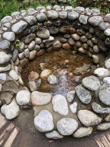 On our first full day in the park, we did several “little” hikes. I’ve decided that Richard’s specialty in life is to drag me to beautiful places and try to kill me. Individually, the hikes we did looked short, but after that day, we did somewhere between 8 and 9 miles of hiking with much of it being climbing. He is very good at his job and I was pretty fried, but we got to see some beautiful waterfalls so I must admit it was worth it. From the Cougar Rock campground, we first took the trail down to Longmire. From there, you can do an easy interpretive loop around a meadow called called “Trail of the Shadows.” Here you get to learn about how the cold springs were used to draw visitors in the early days, with the promise of a spa like, recuperative getaway. Many of the stone pools are still there and there are places where the water bubbles up out of the ground, creating a rusty colored patch of earth made of Travertine. When the springs are cold, the mineral deposits do not clump and crystalize, so it all spreads out.
 Returning to camp, we then took the trail up to Carter and Madcap Falls. This trail takes you first across the Nisqually River and then you climb upstream following the Paradise River until you come to the falls. By this time, we’d already done maybe 5 or 6 miles, so I was feeling it. Really, only the promise of a beautiful water feature can move my feet uphill like that. I didn’t say much and instead concentrated on putting one shoe in front of the other until we got to the lookout. “Yes, it’s beautiful. Fine. How far is the other ______ lookout?” The hike down was considerably easier. On our way, we noticed a long pipeline that appeared to be made out of wire bound wood. Like a long extended wine barrel. We decided that’s what that was and that there must be a wine spigot at the bottom. That would be a fitting reward for such a long day. Tragically, that was not the purpose of the pipeline and Richard found out from a ranger that it had something to do with a hydraulic power project they tried to do in the 70s but was later abandoned.
 Of special note on this day is the fact that Richard got to try out his new Rain Kilt while hiking for the first time. I’m not allowed to tease him about it anymore. He wants me to note that it was highly effective at keeping rain off his shorts and that it packs down very small. No, he does not wear pants. Ever. We got broad smiles from the few other hikers we saw, and laugh all you want, but I’ll bet you’re wondering right now if you also need a rain kilt.
The next day I suggested we drive places. We took the Stevens Canyon Road to explore the eastern side of the mountain, and sure enough, the weather was just a bit less wet. We passed by several beautiful lakes, which I’m sure are even more stunning when the clouds part and they are able to reflect the mountain. No such luck for us.
 We did get out and do some short hikes along the way. One was to Box Canyon. This is a place where there is a deep gash in the rock, with water rushing through vigorously more than one hundred feet below. Part of that trail is closed, but we got a great view and were able to go on the bridge directly above.
Another trail we did was close to the Ohanapecosh Campground. We first checked out the campground and Visitor Center there and first ascertained there is no wifi and no dump. Until we learned that, we were thinking that would be the better place to stay since the eastern side tends to be less wet that over at Cougar Rock. They do have lots of RVs in the campground, but you’d have to find somewhere else to dump.
 This is an interpretive loop called the Grove of the Patriarchs which is an easy walk about a mile long. It takes you through old growth forest and follows the emerald waters of the Ohanapecosh River before crossing over it on a suspension bridge. Here I got several more shots to add to my Richard crossing bridges photo collection. This was the one time in the park where we felt like there were lots of people. We figure this is because the trail is accessible and close to the park entrance. We do wonder if this is how the park would feel everywhere if it were a summer weekend.
 The last hike we did had the potential of being yet another attempt to kill me, but it was not bad. This was the hike out to Silver Falls Lookout. It was a little more than half a mile and ended at the most spectacular falls I’d seen. And that’s saying quite a lot given the watery nature of this park. This falls system cuts through the rock like a maze before shooting out at the bottom like an enormous faucet. The view from the bridge gives you a nice overlook of all the lower stepped terraces. There is a longer loop one can do right out of the Ohanapecosh campground, but I was quite content to do the half mile out-and-back and call it a day. Dinner that evening combined chili and a wifi check in at the visitor center up in Paradise.

With ambivalence, we packed up the next morning. On the one hand, we were both pretty done with feeling wet, plus we could see the park start to fill up with weekend throngs. On the other hand, this was an incredible park and we were sad to leave. In the morning, I walked to the bathroom at the end of our loop and noticed the clouds had cleared enough to see the mountain. I hadn’t brought my phone so I practically ran back to get it. I swear, it cannot have been five minutes before I returned to take a picture, and by that time there was a perfectly positioned “nope” cloud that had moved in, just to spite me.  The park was only temporarily mischievous and deigned to show herself fully before we said farewell.
What a beautiful park. Definitely earns the name, but if that’s what it takes to produce so many wildflowers and water features, so be it.
Total miles from Windy Point: 118.4, 16.2 mpg, 3 hours 5 min. Site C8 Cougar Rock. Flush toilets, dump, not much solar, NO cell service for either. Wifi at Jackson Visitor Center, or Wilderness Center in Longmire. Otherwise, nearest cell service is in the town of Ashford.


 Sometimes you stumble upon something great because you notice beauty and ask, “Can we stay here?” That’s what happened when we headed up Highway 12 toward Mt. Rainier. This was our one transit night where we had no preset reservations. We thought about staying in a state park in Yakima, stopped to check it out even, but decided to roll the dice and keep moving. That turned out to have been a great call.
 Yakima is a very big town in comparison to everything around it. We were surprised that the location of
 Following Highway 12 west, we passed through some truly lovely countryside. Having left behind the golden hills of the eastern side of Washington, the flora and fauna began to come alive, following a peaceful little river right by the road. Coming off of a windy couple of days in the gorge, this area really spoke to me.
 This was Windy Point, and it was blessedly calm. We found a perfect site, right by the river, and set up camp with hours to spare of daylight.
 Dinner was Blue Apron pork tacos with a spicy slaw on the side. With a before dinner margarita and an after dinner glass of wine, I was pretty happy. Plus, we started binge watching “Outlander,” and that’s a fun show, with kilts (more on kilts to come later).


 This destination was really for Richard. He had ridden the Columbia River Gorge a couple summers ago and it had been a highlight. The aim for this visit was for him to ride the Washington side, so we found a state park at the eastern end of the ride that we used as our base camp. Easier than packing up and moving every day.
 A secondary goal for this weekend happened to time with another Bruce maintenance service on the road. We keep clocking so many miles during summer trips that it’s becoming a matter of course that we’ll have to find an Acura dealership somewhere along the way. For efficiency, we planned it such that I could drive the entire route from east to west (90+ miles) with Richard and his bike on board, drop them off at the far west end of the route, and go get an oil change (for the car, not me).
 I followed Richard’s route and caught him about 60 miles down Highway 14. He’s a biking beast. He noted a couple things about doing the ride on that side. First off, he probably started too far west and too close to Vancouver. It was pretty much freeway riding for about five miles and he had to cross a terrifying narrow bridge just outside Washougal. He avoided some of the highway by following the Evergreen Road, but even that eventually dumps you onto 14 before it’s nice. If he had to do it over again, he would start at Steigerwald Lake. Anyway, he made it and I picked him up safe and alive, and drove back to our campground.
 The Columbia Hills State Park campground at Horsethief Lake was really pretty nice. It had hookups and access to a protected little lake right by the river. A happy surprise for us was finding an Altoiste family there when we pulled in. I love that. I also really liked the family and they had lots of helpful information about the area. One thing they said was that, yes, it is always windy there. And when I say it was windy, apparently I mean 20 mph sustained winds because they had a little gadget that measures wind speed. The number 20 feels way too low to describe the constant buffeting, but I fully defer to the gadget. In fact, it’s tops on my list to purchase one of these (in blue). One supreme benefit of the wind was that it was at Richard’s back and acted as a tail wind the entire time.
 The park apparently has been aware of wind for quite some time and there was a nice perimeter of tall, mature trees whose primary function must be to create a block. I noticed it best when I tried to go boating the next day. There was a very distinct boundary in the water, beyond which the wind was just brutal. Staying within the invisible semi circle closest to shore, it was almost like a normal calm day. Cross the line and you’re gonna get a face full of spray and wonder if you could actually be carried out to sea from within a lake.
 Richard’s second riding day began with me dropping him off at Drano Lake. For this stretch, he had to pass through several tunnels. There are buttons you can push to let cars know there’s a bike in the tunnel, and he said almost all drivers were courteous to him. All it takes is one asshole though. He did have someone beep at him in the tunnel, which you can imagine would not be calming. Mostly people were nice, but he did opt to get off the highway and take Old Highway 8, which he says was much nicer and provided spectacular views of the gorge from high above.
 He then arrived back in the campground about the time I was deciding to call the boating quits for the day. We got to do a little walking around the park to look at their collection of petroglyphs. There are apparently more impressive ones, but you have to book a tour with the park ranger because they are in a protected area to prevent (further) vandalism. People suck. If we ever go back, we might want to give that a try. In fact, there were all kinds of historic museums and scenic hikes we did not do. There’s a lot to keep one entertained on the gorge. However, I don’t think I’ll ever be one of the hundreds out there with parasails or sailboards, or whatever you call things you attach to yourself when it’s windy and hold on for dear life. One sad thing I noted was that the damage from last summer’s fires is very apparent. There are entire mountainsides, once densely forested, that are now bare, save the charred remains of thousands of trees. That was a massive fire and the scars will be visible for a very long time. Otherwise, the gorge does not disappoint if you’re looking for a hundred-mile stretch of spectacular river canyon scenery.


 Where is the most happening place to be on the Oregon coast for the 4th of July? Well, apparently it is
 We all had the same thought when we pulled in, and that thought sounded something like Ricky Ricardo telling Leenda she had some splaining to do. However, there was sun. And cell service. And it was right by the beach. So we ended up actually liking it. Dogs likely had a different opinion once the fireworks started.
 Our aim was the Bob Straub State Park and nearby boat launch. We eventually found it, even though it was confusing and seemed to span both sides of an estuary, but it was pretty windy. It’s nice traveling with someone you feel comfortable enough with to go, “Meh, I’m not feelin’ it,” and have them be relieved cause they weren’t either. So instead of getting the boats out, we just messed around the beach for a while.
 We all did a bit of regrouping and decided to meet up at the

 First off, it was packed. This is a three mile beach and there were partiers with campfires going full blast in the sand, as far as one could see. Everyone had their own arsenal, ranging from little stuff, to seriously professional looking explosives. Things really got going around 10pm, since the sun didn’t set until 9ish. Early on, the smoke became really intense, so we kept edging our way closer to the ocean waves. Once it was dark, there were nonstop fireworks all around us. Huge bursts went off overhead, raining little charred bits of paper on top of us. As we looked down the beach, it was hard to tell the difference between the professionally organized displays and those of just regular beach goers who’d spent a ton of money.
 It was reminiscent of a blockbuster movie beachy war scene, but way more colorful and with slightly less screaming. By 11, it was beginning to die down and we retreated back to Dory. That was an experience. No way can you do anything close to that in California. We usually go to city parks with presentable, though not awe inspiring, displays. This was like a hundred times the fire power and none of the organization.
 Friday, we had to say goodbye to our Alto buddies. We’ll be sad not to see them at every campground, and the doggies will be confused and wonder where we are. They are fun and we miss them already.


 So, our whole rationale for coming to the Pacific Northwest for summer was to avoid the heat. And we have checked that box in a serious way, to be sure. We kind of forgot that the thing most associated with this area is rain. Even when we set our sights on seeing things like rain forests, for some reason, it comes as a surprise to us that it could be raining while we’re there. What I’m saying is we’d already gotten a sufficient level of cold and overcast days by the time we arrived at the coast. And of course, it was cold and overcast. And we were surprised when we should not have been.
 Still, the upside to a rainy area is obviously the abundance of green. Lush hillsides, dense and varied forests, wildflowers all along the sides of the roads as though someone planted them. We can’t and don’t deny that Oregon and Washington can boast some of the most lovely natural landscapes anywhere in the world. We just feel that they’d look nicer if the sun came out more, that’s all.
 From Seaquest, we slowly made our way up highway 101 until we found a Walmart. That’s always a fun way to get in some urban hiking and restock groceries. We then headed toward the coast, taking a Google recommended short cut along a rural road until we rejoined 101 at the coast.
 Arriving at Kalaloch, we saw Linda’s Alto set up in the site across from ours, but she was out. We went down to the beach after a nice Blue Apron recreated dinner, looking hopefully at a tiny break in the clouds. I remained optimistic that it would be just enough for a sneaky sunset. I waited patiently until I could just barely seen the hint of something round slowly emerging from the clouds. It could have been the moon, but was in fact the sun getting in one last shot before disappearing for the day. I got some cool shots as the concentration of light made it look like the horizon was on fire.
 As it turns out, while we were snapping photos on the beach, Linda was up above in the campground, shaking her fist at the couple of jerks who wouldn’t get out of the way of her sunset pictures. Then she realized it was us and took some really nice photos. She even thought to get a reflection picture of Dory. She’s awesome that way.
 The next day, Richard wanted to ride the road that went to the Hoh Rain Forest. I got to drive it and take pictures, which is always a treat. At the end, we hiked a couple of nature trail loops to see what they dub the “Hall of Mosses.” That’s a truly beautiful hike and very easy at less than a mile. The other loop is just over one mile and provides a nice little meet up with the Hoh River about half way through. We didn’t see much wildlife but we sure did see lots of pretty plants and flowers. Nice way to spend a day.
 In the morning, we got a surprise. Thank god Richard thought to look at the reservation tag on our site. He noticed it said that our departure date was listed as that day. Somehow, I messed up and only reserved two nights when I thought I had reserved three. Had he not seen that, I really would never have known until someone kicked us out of our site, and by then we’d be out of luck. As it was, we were able to jump on a newly open site and just move over one loop. Kind of a close call and now we’re double checking all remaining reservations well ahead of time. Sheesh.
 On the way back, we stopped at Ruby Beach and caught a glimpse of some tide pool creatures. Linda saw more at Beach 4, but she got up at 7am, so she earned it. We got the lazy person’s view and it was still pretty cool. After dinner, we took a drizzly walk to the Kalaloch Lodge for soft serve ice cream. Perfect day.


 Our departure from Elk Lake found us in the middle of a massive bike race. It was actually no small feat to navigate without simply driving into oncoming traffic. Everyone seemed to be on the same page though and drivers were courteous and slow, at least from what we saw. Before leaving the Cascade Lakes region, I got in a few nice shots of Dory in her element, and then it was an easy descent into Bend. What a lovely place that seems.

 We tracked north along highway 97, and then 26, through the eastern side of the Cascades, until we eventually hit I-5 past Portland, and took it north. Seaquest is a state park, but sits right across the street from an impressive visitor center all about Mt. St. Helens National Monument. We did get to experience it in the morning after we’d packed up. There’s a nice big parking lot with RV spaces, only a couple of which were taken by rude people with tiny cars.

 We listened to a ranger talk and watched a movie about the 1980 eruption. I guess I must have been in high school at the time and I do remember it, sort of. But really only as a, “Oh yeah, did you hear Mt. St. Helens is erupting?” conversation starter. I did not realize the full impact on the area, nor the extent of how far the ashes traveled. The visitor center had video and photographic depictions of the explosion and it was frankly terrifying. The theme for this summer seems to be volcanoes, and I will say I have developed an acute appreciation of the massive, destructive power contained just below the surface.
 As this was our first one night stand of the summer, it felt rather out of step with our nice, slowed down groove. It was a long drive from Elk Lake though, so for sure I was happy to stop and do an overnight. We think we might want to go back there at some point because there was a lot to explore. As such, it was still a lovely place for a stopover on our way north.


 We headed out Thursday morning with Linda and her pack, and headed up I-5 to Weed in order to dump tanks. That turned out to be a Pilot travel center and they can boast a five star rating for their dump station scenic view. They also weren’t too expensive ($10) and situated in a pocket of super fast LTE. Richard got some work done and I got to upload past pictures and get all caught up on the blog. Very productive.
 From there, we cut eastwards along highway 97 until we came to Klamath Falls. There we met up to do a bit of grocery shopping. I will note a couple of things with groceries. First and foremost, so far the Blue Apron experiment is going very well, both with the grill outside and with the Dory stove indoors. My pantry is nicely stocked with the specialty stuff so all I have to get is meat and veg. Mostly we can find what we need, or at least substitute (like snow peas if we can’t find Bok Choy, for example). I am going to need to replace some of those things before we get home, pepper being one of the items because I had a pepper explosion earlier on. The corn and tomato salad was way way way too au poivre, but we were hungry and just picked most of it out. Mmm, crunchy. Point being, I’ll need pepper earlier than planned.
 We climbed up into the Deschutes National Forest and got a little preview of the bike route Richard wanted to ride. Wow, what an incredibly beautiful place this is. There are lakes just about everywhere, with views of Mt. Bachelor and other snow covered volcanic peaks rising up around every turn in the road. The road conditions are excellent, well paved and evenly graded. There are some long climbs and descents, but nothing as steep as the Sierras.
 We pulled into our Forest Service campground in the afternoon and got set up just as a short shower opened up. That was a good cue to hunker down and make dinner. Before bed, we took a little stroll downhill to the lake and grooved on the peace and quiet. And if that were not enough to make us feel jolly, once the sun set, we discovered the little tree right next to us had been decorated with solar Christmas lights. We’re not sure if someone forgot them from last December, or if it was an intentional gift to future campers. The temperatures approached freezing that night, so it certainly felt holiday-ish. It was so cold in fact that we ran the heater and resorted to pulling out the wintertime fleece blanket (which we refer to as “technology”). We had full-blown condensation on the windows in the morning, causing us both to remark that it was late June.
 That day, Richard set out on an ambitious loop ride. I messed around with a tentative plan to go boating, until I got his text that he’d broken a spoke. No problem, that’s why I don’t go biking, I figure. Then there’s someone with a car who can cover 20-30 miles in as many minutes and bring sad bikers to the nearest bike shop. As Richard called around to see who might be able to do the repair job, he discovered that this was the weekend of a HUGE bunch of events in the area. There were triathlons, Iron Man races, bike races, just a ton of activity all centered in this region, and it was much harder than one would think to schedule time with a mechanic. Nevertheless, we brought sad biker with his sad wheel into the town of Sun River. There was a minimum of fifteen million bikers packed into this tiny village, I’d estimate. Every other store seemed to be a bike shop, and yet, with all of the craziness of pre-race festivities, only one place had a mechanic handy. Super thanks to 4 Seasons Recreation for doing the saving. They had him all fixed up and I had him back on the road, pretty close to where I’d picked him up, so he could continue his circuit.
 It was actually a pleasure to go out and save him because I got to enjoy the spectacular scenery for myself. And there was plenty of time left in the day for an afternoon paddle on the lake. Linda et chiens joined me out there and we had fun gliding around and taking pictures of each other. A tiny yellow jacket appeared way off on the shore and that told me Richard was back and had completed his loop. He brought back some amazing pictures and a sense of triumph over adversity. We both agree I am way better as a SAG wagon than I ever was as a long distance biker. I imagined the scene had my butt been out there with his, broken down on the side of the road, looking at having to pedal seven miles out of the way to a bike store, with what? His wheel strapped to my back? Nope. I really like my car, thanks. I can cover that distance in no time, even up hill, plus listen to music.
 This campground was super sweet and we thank Linda for letting us stalk her on this part of our trip. She knows her stuff. Some of the sites are reservable, some not. Ours was a great site with a view of the lake and a short walk down to a nice sandy beach. There are vault toilets and water spigots, and it’s a good thing we have lots of leveling blocks because the sites can be tippy. Nice place and we’d love to go back there!


 This one comes from the recommendation of a very good friend and it has ended up being one of my favorites so far this summer. Her family has been coming to the campground for over 75 years, so it holds special meaning for her, and I can absolutely see why. It is a National Forest Service campground and one of the more popular. Not all of the sites are reservable, but some are, and we were lucky to get in since it’s a small campground. The location is just to the east of the small town of McCloud. It’s actually not that far off I-5, a stretch of highway we’ve flown down countless times. Again, we were struck by how much sheer natural beauty we have been missing in this part of the state.
 As soon as you pull into the campground, you can hear the sounds of a rushing river. I imagine this is what it looks like when it’s very full. Just a short walk down a paved trail, you can get to the Lower Falls. That alone is worth the price of admission, but turns out to be not the most spectacular of the three falls. We pulled in lateish on a Monday and just had time to check it out and do dinner. We were really happy with how strong the cell service was at the campground!
 Richard needed to get some work done the next day, so he biked over to “Hoo Hoo Park” in McCloud. That had to be the prettiest office anywhere if you’ve got to spend the day being productive. The views of Mt. Shasta from that area are incredible.
 Someone clearly planted the clusters of leafy greenery, clinging to the sides of the river and waterfall precipice. No way did that naturally occur. In fact, the whole perfectly cascading look of Middle Falls looks unrealistic and idealized. The landscape designers did a great job.
 This one is more like a crazy, and most definitely deadly, amusement park water ride. The river here is more compactly channelled into a high speed chute that plunges over a rock wall like a fire hose left running. We noticed birds doing maneuvers up and down the channel that could not have been for any purpose except that it was fun. On our return, I booked it down the trail, fast enough to catch another gorgeous sunset over Mt. Shasta.

 We celebrated with breakfast for dinner (pancakes, sausages, scrambled eggs, all cooked on the grill) and went for an early evening hike up to Middle Falls. Her doggies were obviously thrilled to be out of the car and frolicked merrily down the trail.
 The cell service is fantastic. I didn’t explore kayaking, but I understand there is a lake or reservoir pretty close by. If it had been hot enough, there are some swimming holes along the river that would be fun to cool off.


 For someone who is generally pretty organized, I seem to have chosen a highly inefficient route through Northern California. We started up north at Burney, then travelled south through Lassen and to Plumas Eureka, and now we are backtracking the same path, northwards up to Almanor, and next to McCloud. Surprisingly, the inefficiency and repeat route driving is not bothering me, probably because it is very, very pretty up here.
 After almost two weeks with no hookups, the North Shore Campground at Lake Almanor was a huge treat. Our site was a waterfront spot with hookups. The only trick was that it was situated in a fully backwards orientation. Like, if we’d just backed in and left it, our door and porch area would be facing our neighbors, rather than the lake. Caravan Mover to the rescue, drawing a crowd and many questions from onlookers as we did a 180. One needs to be careful when doing this since the electric and water sources might end up being too far away, but everything reached.
 Richard got in a full day’s ride around the lake and I drove it, catching up with him in places. It’s around 37 miles but not too hilly to get around. There are fantastic views of Mt. Lassen on the horizon from all around the lake. The area is described as a “poor person’s Tahoe.” Overall, we came away with a much better impression of the place in comparison, mainly due to the fact that you are not suffocating in a nonstop traffic jam. There might not be as many cutesy little markets or restaurants, but we were quite content. I don’t think we’re high end people.
 On another day, Richard headed up Warner Valley Road. This is a woodsy ride that will ultimately take you to a three mile gravel section that enters Lassen National Park from the south. It only recently opened for the season, but the roads were in good condition, albeit a bit lumpy in the paved parts. I picked him up and we drove the last few miles until we came to a staging area. There we hit the out and back trail to Boiling Lake. What a beautiful trail that is! The first bit takes you near a river and parts of it are boardwalked, to keep you above the slushy meadow floor. Then you cut uphill, but not too steep, to get to the lake.
 Along the way, Richard spied a big ball of brown fluff, silently foraging in the trees. He sort of whisper yelled, “SWEETIE” to get me to halt. Halt I did. Froze. Then slowly backstepped. Yeah, this was for sure a very young bear, which meant mama had to be close at hand somewhere. There was another group on the trail and we sort of clustered with them, loud talking so as to make our presence very well known. I snapped a few long distance blurry pictures as the potentially lethal ball of fluff bumbled its way over a large fallen tree and disappeared. It was simultaneously adorable and terrifying. We waited a good long time before proceeding, and we continued talking nonsense to each other as we went. I’m frankly impressed with our ability to continuously babble while hiking.
 After about a half mile of intense scanning and slow walking, we came to one of the weirdest natural phenomena I have ever seen. We’d missed out on all of the thermal attractions at Lassen because of the snow, so it was seriously cool to be able to see this one. You could smell the sulphur as you approach the lake, and once you’re close enough, you can hear the glub glub of boiling mud pots. At the far end of the lake, steam rises up, marking the place where the highest heat energy seems to be concentrated. The entire lake can be seen slow boiling, making the weirdly colored milky green water look like a huge soup pot full of melted opals. The ground around it also had a brightly colored, rusty hue. It was a fascinating little geological anomaly, right in the middle of your typical pine forest. Needless to say, we continued the scanning and talking as we hiked back to the car. No more bear sightings, which was both a relief and a disappointment.
 I was able to get in some nice boating on the lake, launching right across from our site. What I discovered was that there are two modes for this lake: super windy, or immersed in a thick fog of tiny flying insects whose only goal in life is to land on boaters and die. After experiencing the windy version, I tried again near sunset thinking the swarming clouds had to stop once you got past shore a bit. I’ll just say, if they do, I was not courageous enough to find the outer rim before I kind of started freaking out. They were not biting (I kept telling myself), but after you are covered in a certain number of bugs and/or bug carcasses, it gets unnerving. I don’t know what specifically that number is, but I surpassed it and paddled back to shore as quickly as possible. Before packing the boat away the next day, I took a brush broom to the whole thing and even that was mildly upsetting.
 We stayed a total of three nights and it was great to really charge up all the stuff. When you’re “camping” with an espresso machine battery, projector battery, speakers, iPhones, and all the rest, occasional hookups are awesome. Yes, we can top up with the generator, but that’s just for a couple hours a day, at most. To really recharge, nothing beats a couple days of juice.


 Another blue pin goes in our state parks map, this one being the recommendation of a very cool teacher friend. I think he would really prefer I not blog about this place at all, frankly. So let’s just say, it was, meh. It was ok. No big deal. Not worth the trip really. You’ll see from the pictures it was nothing special. Definitely don’t go there.
 This region of CA is the quintessential Sierra Nevada experience. As such, you are going to be in for steep climbs and descents, no matter what route you take. This is important to recognize if you’re planning a biking or hiking outing. The climb into the park itself is a serious grind, hitting 15-20% grades in a seven-mile, sustained uphill challenge. And, as with many state parks, as soon as you begin the ascent off the main road, cell service completely drops out. The reward speaks for itself if you’re looking for a genuine, high Sierras, remote camping experience. The upper Jamieson Creek loop straddles a river that is running full throttle right now, following a very wet winter. Meadows along the way are in full wildflower bloom as well, so coming from the north, down Highway 89 most of the way was definitely a treat.
 This is not a big rig campground, though we did see some longer trailers managing to squeeze into the sites closer to the river. Our site had plenty of room between other sites and good privacy in the form of trees and shrubs. It was a bit of a challenge to level, including leveling the grill in the picnic table area. Good thing we came prepared. There is also no electricity anywhere in the campground and even the lights in the bathroom are powered by propane.
 We got lots of fantastic advice from my buddy, including all the places in the little red town of Graeagle where there’s WiFi. It makes for a perfect little shot of civilization, where you can find everything you might need, including gas, groceries, restaurants, and cute artisan stores. And, of course, cell service. It’s a nice safety net to balance the rustic seclusion of the campground. This worked out perfectly for Richard, who needed to get some work done during the week.
 I got to hook up with some Altoistes friends who happened to be in the area. I was really worried we’d pass each other as we headed down to town in a cell service dark zone. Had they mentioned they had a huge animatronic gorilla in tow, I would not have been as concerned about missing them. We had a lovely time catching up, including hearing the story behind the gorilla.
 We then got to do some driving in the Lakes Basin area, partly to get some beta on whether this would be a reasonable bike ride for Richard. Short answer: yikes nope, at least not the whole thing. Once you get up the huge, relentless climb, the road becomes more of an up and down roll, so that part he was able to do. There are so many mountain lakes up there, I don’t think I could identify which picture belongs to which lake.
 Around every corner there is another one, each with its own uniquely breathtaking backdrop of snow capped peaks and lush pine forest. The water is crystal clear, being comprised largely of snowmelt. Rivers crisscross the landscape in between. It is just stunning.
 That afternoon, we returned to Salmon Lake and I got in a nice paddle while Richard rode a truncated, post crazy climb, version of that road.
 In a word, I’d sum up this campground as remote. It would actually only take about four hours from home I guess (not towing), but you get the full woodsy experience in a state park run, well maintained campground. There are plenty of national forest campgrounds in the area and up by the lakes, with vault toilets and some sites that might accommodate a small trailer like the Alto. And really, the campground roads are all paved and civilization is a mere seven miles away, so it’s not as out there as it feels. Kind of a high Sierra camping Nirvana. And by that I mean, it’s terrible. Awful and hellish. Stay away for sure.


